Staff Report
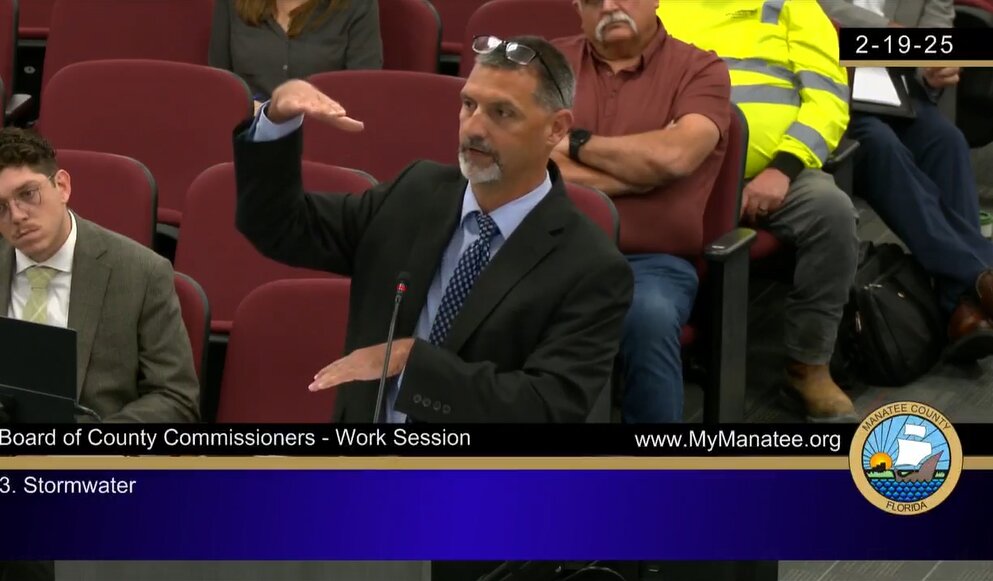
BRADENTON — During a Manatee County Commission workshop on Wednesday, Tom Gerstenberger, Stormwater Engineering Division Manager at Manatee County Public Works, gave board members a detailed presentation on the current state and future needs of the county's stormwater management capacity.
The following is a summary of Gerstenberger's presentation:
County Stormwater Maintenance Suggestions
- Routine maintenance interval of designated drainage systems by the county
- Maintenance of additional drainage conveyance systems through dedication of drainage easements to provide means of access and address permitting needs, if any
- With respect to storm-related service requests, determine the need for drainage easements or a one-time recording of the right-of-entry agreement
- Six-month maintenance for "hot spots" (bridge crossings, culverts, etc.)
- Six-month maintenance for man-made drainage system (major drainage canals, ditches, etc.)
- Annual maintenance of natural drainage systems
Goal: Maintain and improve conveyance capability to transport runoff and floodwaters
County Stormwater Maintenance Regulatory Requirements:
- Regulatory requirements never anticipated the need for routine maintenance of natural systems over time, natural drainage systems become restricted by deadfall (downed trees, sediment deposits, etc.)
- State and federal permits are required for the maintenance of both natural and man-made drainage systems
- Regulatory process is very stringent on ecological impacts (vegetation, wildlife, habitat, etc.)
- Jurisdictional waters and sovereign submerged lands: the state owns the land below ordinary water level.
- Federal and state ownership and jurisdiction can vary
- Mitigation for wetland and habitat impacts through credits range from $100,000 to $400,000 per acre.
Suggested Regulatory Revisions:
- Higher design standards: 100-year design storm or 500-year design storm, which would bring new development designs to higher resiliency standards but have no effect on existing development.
- Critical design storm (single-day/multi-day storm events)
- Utilization of NOAA Atlas 14 for modern rainfall accumulation for the weather service, which is utilized by FDOT for drainage design.
- Flood mitigation areas: effective flood storage mitigation through sole-use mitigation areas, typically directly connected to adjacent drainage conveyance systems. May require additional space within the development project area.
- Volumetric analysis: Provide a comparison of pre-development vs. post-development volume of rainfall runoff, which requires development to retain increased volume onsite with impoundment/retention ponds.
- Restrict development within 100-year floodplain and floodway
- Street level of service standard: identifies the allowable depth of flood inundation across a roadway at 6 inches.
- Demonstration of no adverse drainage impacts: require mass grading plans, dewatering plans, and best management plans to demonstrate no adverse drainage impacts on surrounding properties.
Gershenberger closed with the following summary of options for future consideration by the board:
- Create a unified stormwater management program to address maintenance, watershed management plans, and regulatory standards, identify effective improvements, and reduce flood damage caused by future storm events.
- Implement funding mechanism(s) for the stormwater management programs
- Amend Flood Insurance Rate Maps (FIRM) with completed Watershed Management Plans (WMP)
- Require continuous updates to Watershed Management Plans through permit/plan applications
- Revise the Stormwater Design Manual to modernize regulatory standards as discussed
- Coordinate revisions to regulatory standards with Sarasota County and state regulatory agencies
- Perform assessments for stormwater conveyance systems with respect to flood-impacted areas
- Acquire drainage easements for perpetual maintenance of drainage systems that convey runoff from public infrastructure
- Continue Vulnerability Assessment and Critical Infrastructure Inventory
- LIDAR topographic data and Bathymetric surveys
- Continue Work Sessions/Outreach with the board, citizens, and stakeholders
- Coordination with the Natural Resources Department on the water quality component of the county's NPDES-MS4 permit
To see the slideshow presented to commissioners, click here. Video of the meeting had not been uploaded to the county's YouTube channel as of press time.



Comments
No comments on this item
Only paid subscribers can comment
Please log in to comment by clicking here.